The problem
Official Philippine poverty statistics come out infrequently and only to the province, so policymakers cannot see which communities inside a province are poorest.
What I built
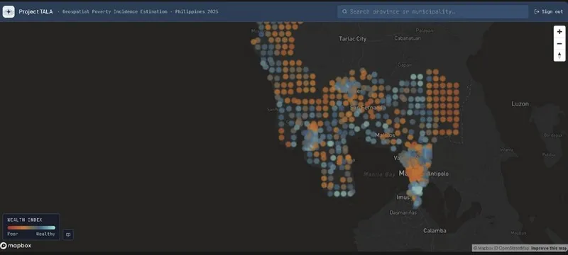
With three teammates I built a model that reads a year of Sentinel-2 satellite images alongside road, building and night-light data to estimate a wealth index for each community, and a dashboard for policymakers. I built the data pipeline in Google Earth Engine, worked on the diagrams and ran the user survey.
What happened
It reached a correlation of 0.73 with survey-measured wealth in cross-validation, in line with published studies, and mapped 1,970 communities across 16 provinces. It shows wealth gaps inside provinces that official averages hide.